
Industries
Critical Infrastructure
Critical Infrastructure
Airspace Protection
Drones don’t respect fences. Your security perimeter has a gap overhead, and traditional systems can’t see it. Dronetag provides passive monitoring and continuous coverage for your airspace, with compliance-friendly detection that deploys in minutes.
Get a quote
Contact us
Get a Tailored Solution
Deploy Assets
Start Aispace Surveilance
.webp)
Customers Are
Saying
Reliable and compliant equipment is vital for UTM development. That's why we at OneDrone have chosen Dronetag as our solution for Remote ID requirements. With its seamless set up and comprehensive data provision, Dronetag is the ideal choice for any drone operator looking to ensure safety and compli
As the official DJI Enterprise Dealer, our passion lies in providing our customers with the best products and comprehensive services. That's why we prioritize offering top-quality items, including Dronetag Remote ID devices, to ensure our customers have a seamless and safe flying experience.

Automatic sync of flight logs from Dronetag App to DroneLogbook accounts is a great added value for users. Using DroneLogbook + Dronetag is not only the way to become compliant with the latest regulations but also an easy option to have data of your whole drone fleet in a single platform regardless

Drone operations safety is encoded deep in the Yuneec’s DNA. As we believe that drone identification makes the airspace much safer and more predictable, we decided to offer the Remote ID feature to our customers immediately. And as Dronetag worked on the technology for the last years, getting them o

As a joint venture between DFS (German ANSP) and Deutsche Telekom, we are pioneering the future of drones and their safe integration into airspace. Our collaboration with Dronetag enabled us to swiftly integrate Remote ID data into our Unmanned Traffic Management platform to meet all requirements fo
Operational Scout Installations
500+
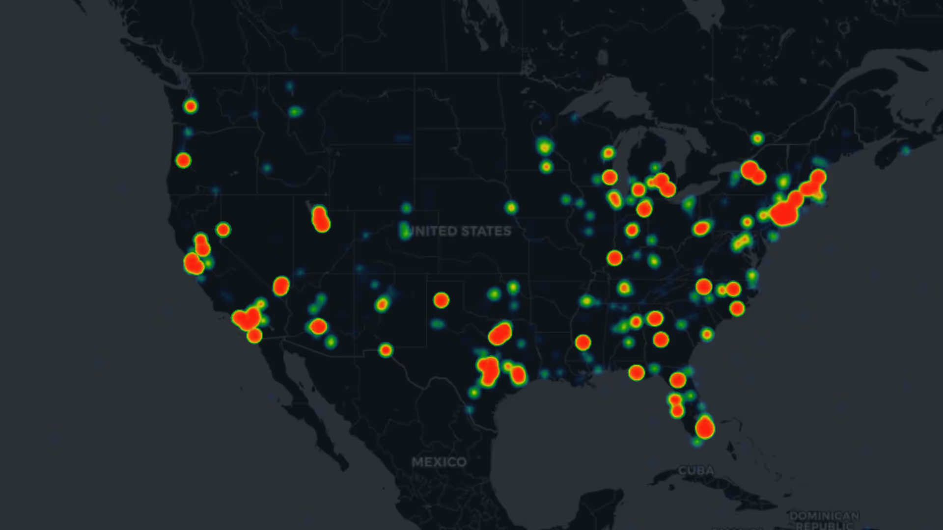
Monthly U.S. Unique Flight Detections
10,000+
Armed Forces
12+
Countries
40+
Typical C-UAS systems ≈ €2115 per km²
Expensive to scale
Slow to deploy
Slow to deploy
Dronetag Scout / RIDER from €105 per km²
Fractional costs
Fractional time
Built to integrate
Facing
An Invisible Threat
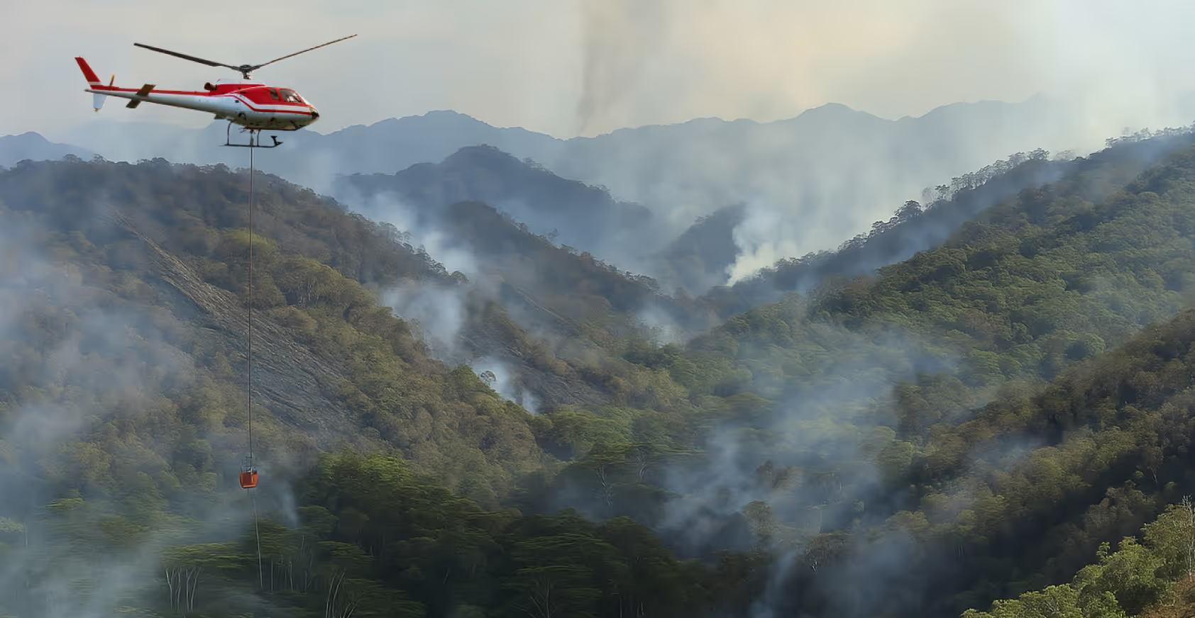
Critical infrastructure sites, from power plants and airports to water treatment facilities and government buildings, face a new category of risk from above. When a drone appears in restricted or sensitive airspace, intent is unknown. It could be careless, curious, or deliberate, but the risk is real until proven otherwise.
1
Operational Disruption
A single drone entering restricted airspace can force a facility shutdown, ground flights, or halt production. The cost isn’t just the direct downtime. It’s the cascading impact on dependent services and the resources consumed by every security response.
2
Surveillance and Reconnaissance
Drones equipped with cameras can map security layouts, monitor personnel patterns, and gather intelligence that enables further attacks or unauthorized access. The reconnaissance flight often comes before the real threat.
3
Payload Delivery and Safety Hazards
From contraband drops at correctional facilities to the potential delivery of hazardous materials, drones can carry payloads into areas conventional security wasn’t designed to protect. Collisions with aircraft or workers represent direct safety risks that demand a detection capability.
Gain Sitautional Awareness
Detect & Identify
Traditional counter-drone systems are often costly and take hours, if not days, to deploy. Dronetag provides an almost instant solution to the majority of security incidents. Our field-proven system identifies not only the drone but also the pilot’s real-time location, enabling you to act decisively and resolve the situation at its source. And once the incident is handled, whitelisting your own fleet and known operators means future alerts focus only on genuine unknowns, cutting false alarms and sharpening your response over time.
Get a Quote
Step 1:
Deploy Detection Devices
Place your digital shield. Our detection tools are the eyes of your airspace security system. RIDER clips to a vest or mounts on a vehicle for mobile coverage. Scout installs on a pole or wall for permanent, long-range monitoring. Both are operational within minutes.


Step 2:
Detect Intruders
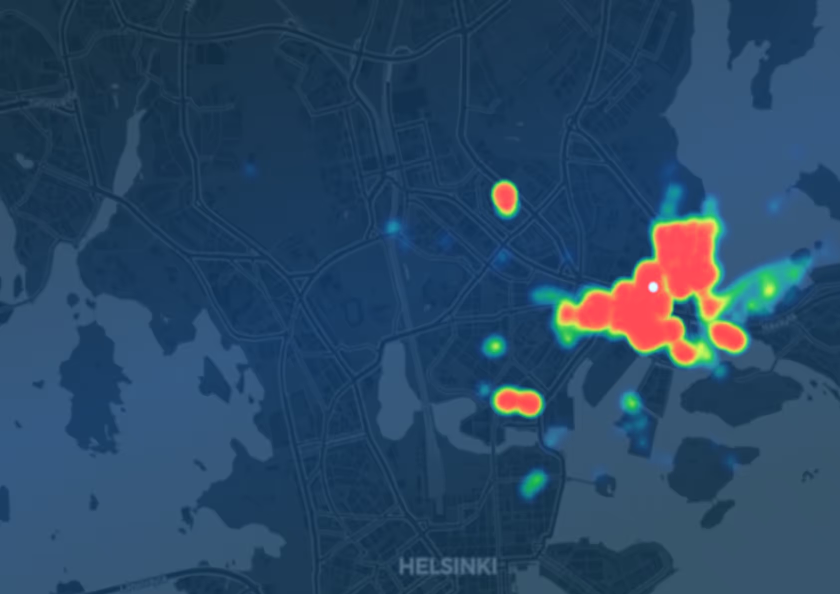
The moment a drone broadcasting Remote ID enters your coverage area, the system captures its identification, position, altitude, speed, and the pilot’s location. An unauthorized drone triggers an immediate alert with all the information your team needs to assess and respond.
Step 3:
See the Full Airspace Picture
Scout’s optional ADS-B extension adds manned aviation data to the same view. Your operators see not just drones, but also nearby aircraft, helicopters, and other airspace users, creating a complete low-altitude traffic picture from a single platform.


Step 4:
Tag Your Fleet
Equip your own drones with Dronetag Mini to make them visible inside the system. Tagged drones are automatically whitelisted, so your security team instantly distinguishes between your authorized operations and unknown intruders. Observation flights, maintenance inspections, perimeter patrols – your fleet shows up as friendly, everything else gets flagged.
Step 5:
Watch in Real-Time
The Dronetag App is the central brain of the ecosystem, available on iOS, Android, and the web. It consolidates all detections, tagged fleet positions, ADS-B traffic, and alert zones into a single real-time view. Replay historical incidents, export data for compliance reporting, and manage your entire detection network from one interface.

Secure Your Facility Today
Let’s Get in Touch
Get a Quote
The Dronetag App is used to manage all devices, plan and analyze flights, and export data. It offers a robust set of features, including whitelisting of authorized drones, the ability to draw custom alert zones and set notifications, overlays of flight grids, access to detection history, and detailed playback of past flights. All data is securely stored in the cloud and can be exported in open formats for further analysis and processing.
Request a custom offer
Flight Monitoring
Monitor your fleet with real-time flight paths and detailed telemetry
Device Management
Set-up, manage and update all your devices in one place
Flight History & Log Export
Replay historic flights and export data in multiple open formats
For Developers


Safeguard your Airspace With Dronetag
Dronetag is one of the companies selected for the European Defence Industrial Strategy (EUDIS) Business Accelerator, the EU’s programme for scaling dual-use technologies that strengthen both civilian and defense capabilities. Our detection technology is designed, developed, and manufactured in the EU, built for the security requirements European infrastructure operators face today.
Get a Quote
Fractional Costs
A fraction of the price of traditional C-UAS systems, with coverage that scales across multiple sites.
Fractional Time
Operational in under 5 minutes per deployment. No specialist contractors, no complex calibration.
Built to Integrate
Open API, MQTT, webhooks, TAK, SAPIENT. Connects to your existing security architecture.
Take Off with Dronetag Now
Whatever your airspace needs, we’ll help you find the right setup from hardware to integration.
.svg)
